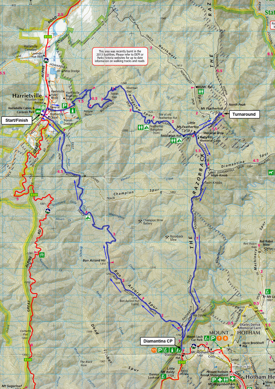
40 km Loop
The 40 km loop starts at 06:00 A.M. at the Harrietville camp ground.
From the campground
- Proceed up the road, turn left onto the highway, crossing it with caution and run past the old General Store. Turn up Feathertop Lane and across the footbridge, then turn right onto the road and run up to the entry to the national park, on a bend in the road, there is a sign on the right hand side.
- Proceed up Bungalow Spur, past Federation Hut and up to the Cross. At the sign posted track junction take the track marked Mt Feathertop summit and continue on to the summit of Mt Feathertop, (there is a track to MUMC hut about 500 m along the track (do not take this unless you need to get water from the spring – about 5 min along the MUMC track). Runners should note that the actual summit is the second peak that they get to.
- From the summit return to the Cross and then follow the Razorback track to Diamantina Hut. Ignore the track to your left to Kiewa Valley—signed as Diamantina Track—many people go the wrong way here. Check in at Diamantina Hut—water, refreshments, first aid, and then double back to the start of the Bon Accord Spur (proceed straight up the hill—not around the side).
- From the junction of the Razorback and Bon Accord Spur head down for 9 km. Cross the river at the bridge to the left of Bon Accord Spur once you hit the river flat for easy running to the finish. When you exit the track, there is a Parks Vic sign and a road junction, veer right and follow the track all the way to the bitumen road and on to the main road, cross it with care and head to the finish at the caravan park entry.
NB: the start of the Bon Accord track is steep and treacherous underfoot—take care. After about 5 km you cross Washington Ck for easy running to the finish. When you exit the track, there is a Parks Vic sign and a road junction, veer right and follow the track all the way to the bitumen road and on to the main road, cross it with care and head to the finish at the caravan park entry.
NB: there is no water along this trail once you leave the spring near the Cross until get to Diamantina Hut. The next water is at Washington Creek.
Elevation Profile

To download the JPEG file, click here.
Maps
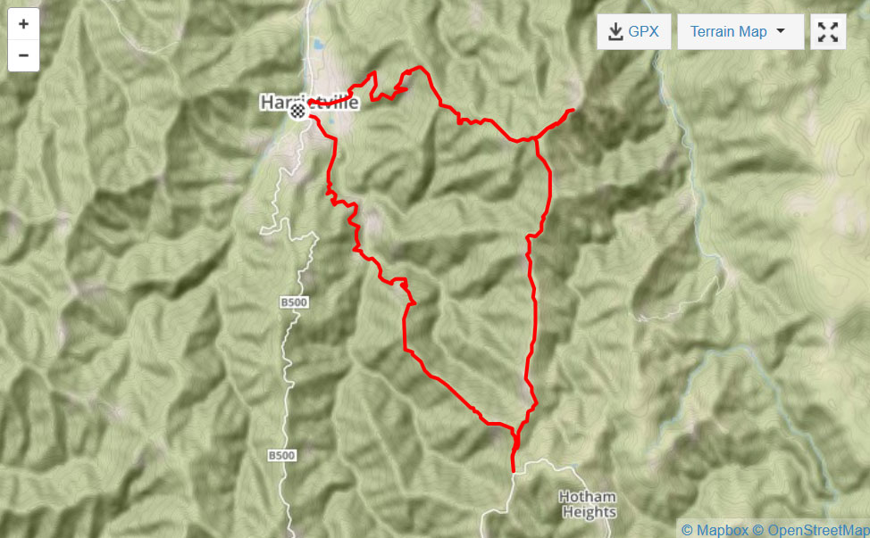
Map, elevation profile and Strava activity by courtesy of Siqi Wu https://www.strava.com/activities/267830601
To download the pdf, click here.